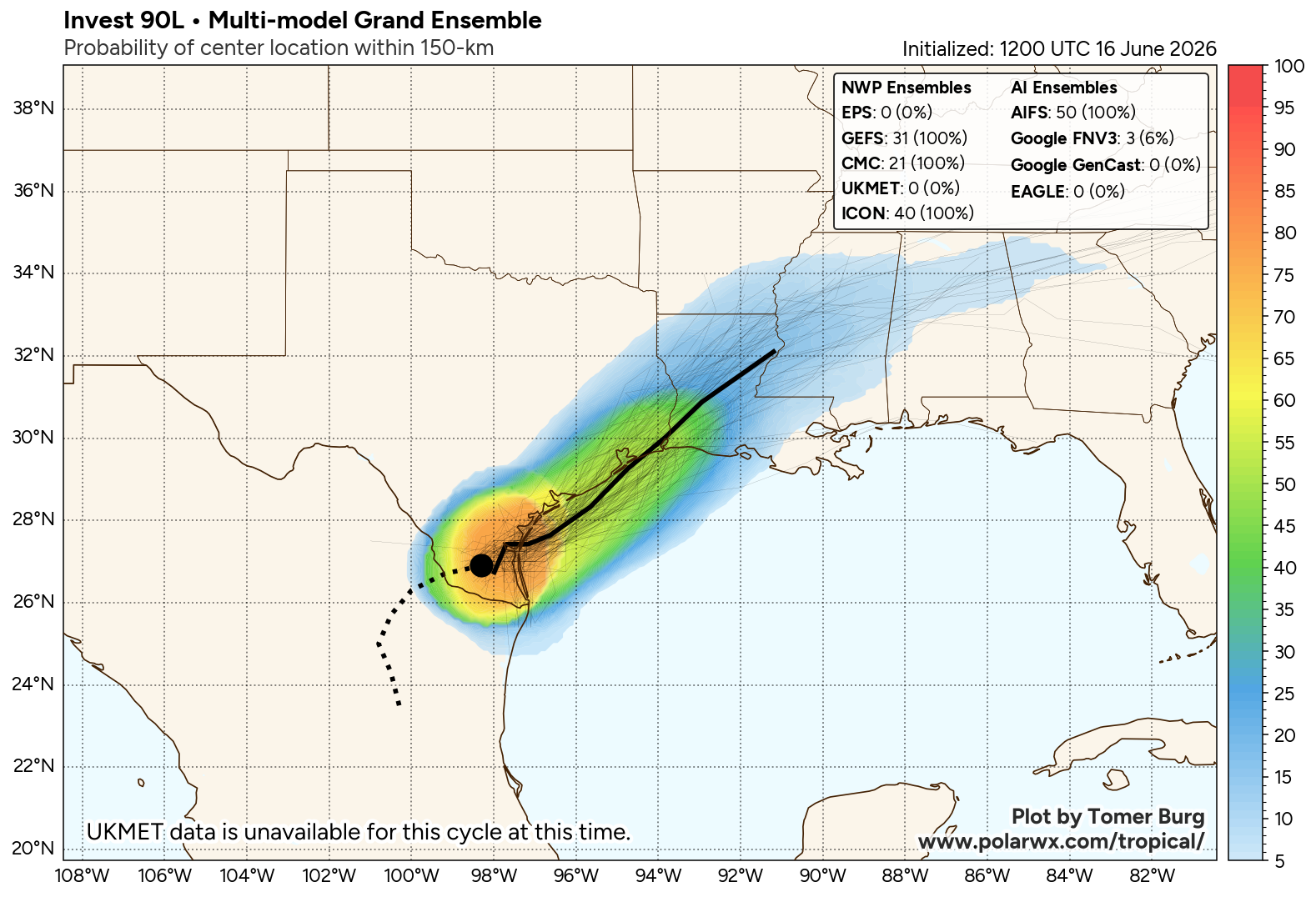
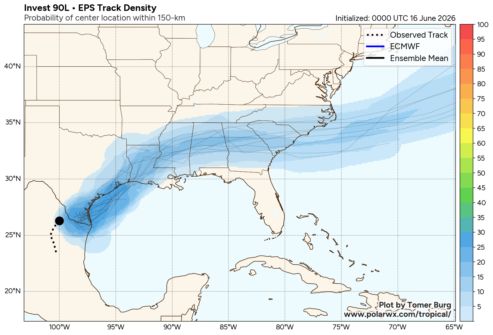
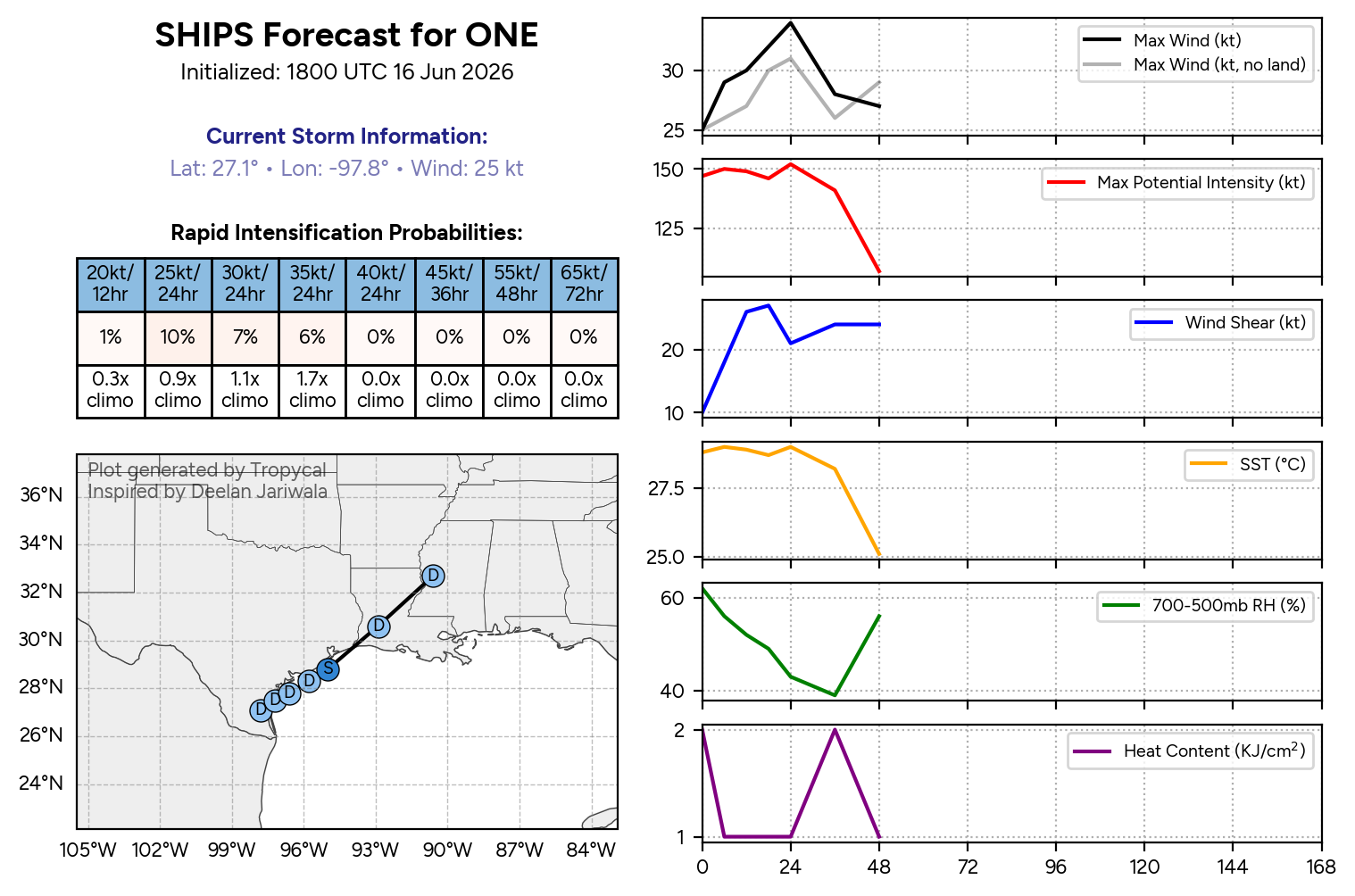
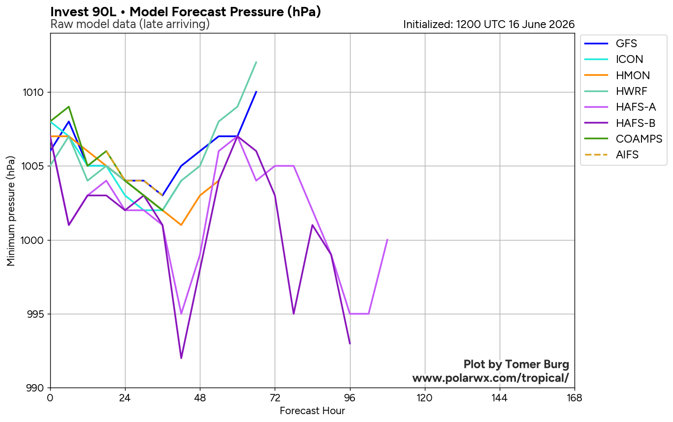
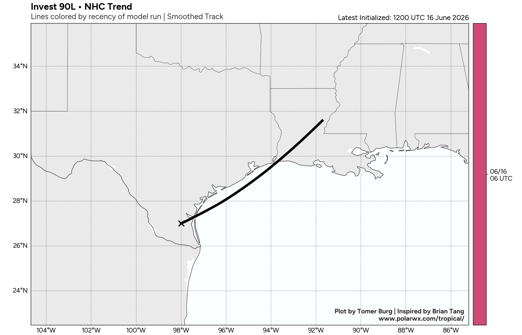
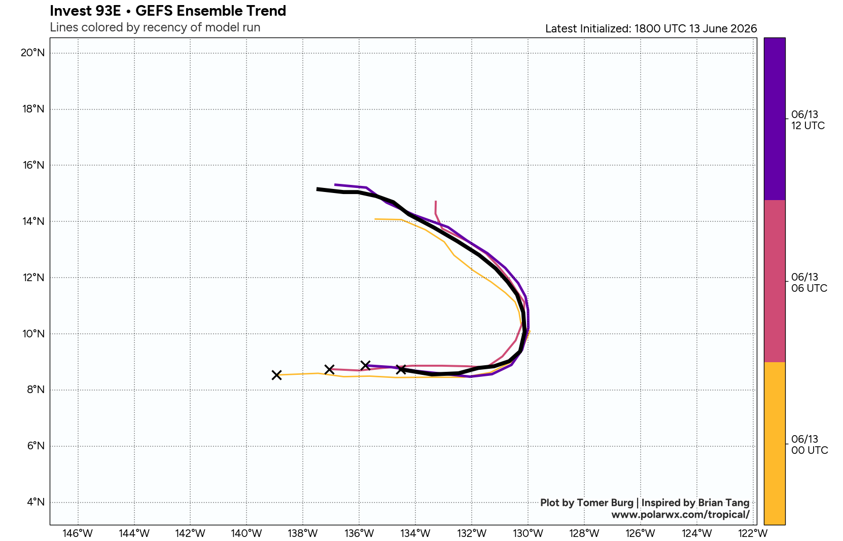
JTWC Issued: 2000 UTC 16 Jun 2026
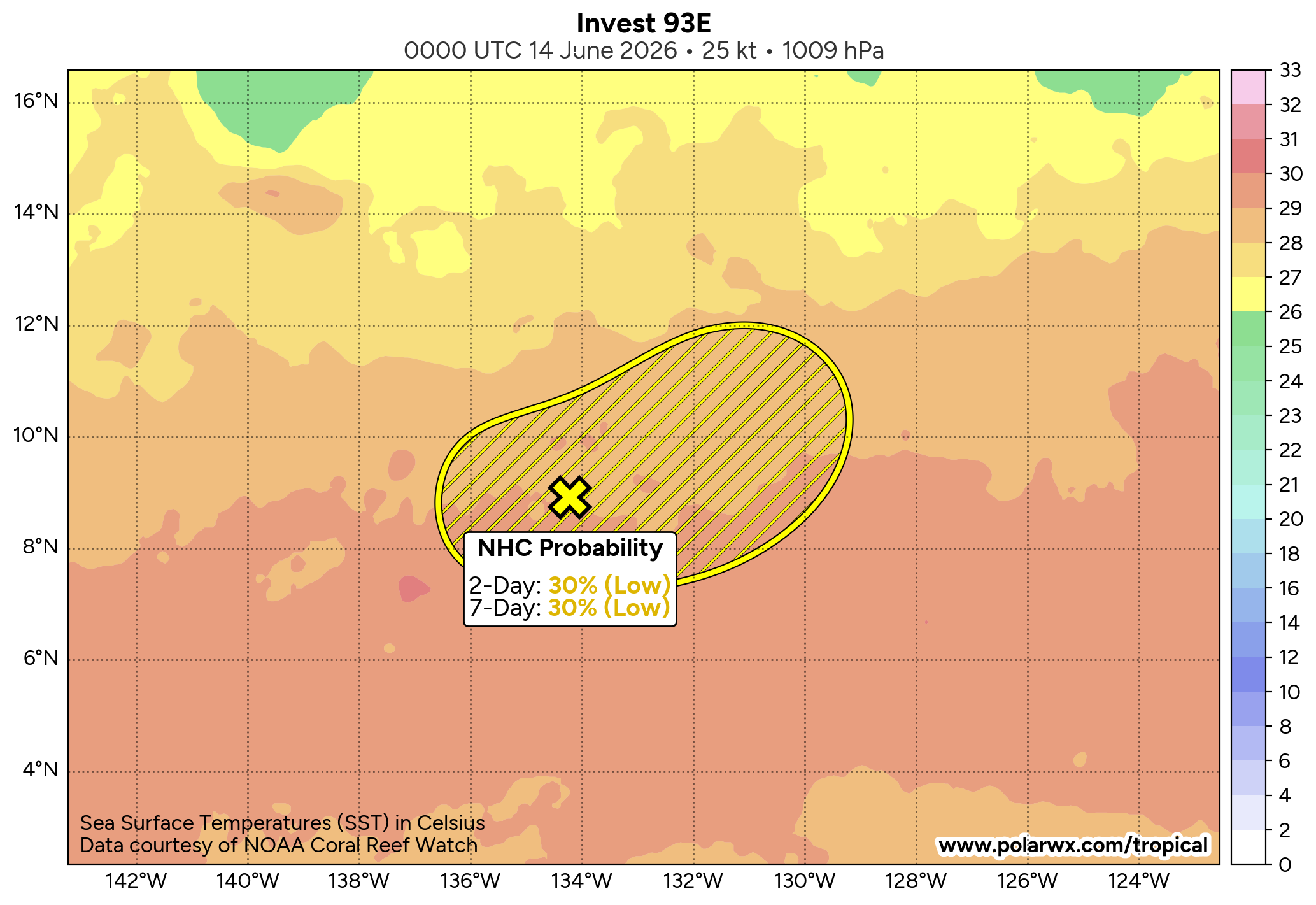
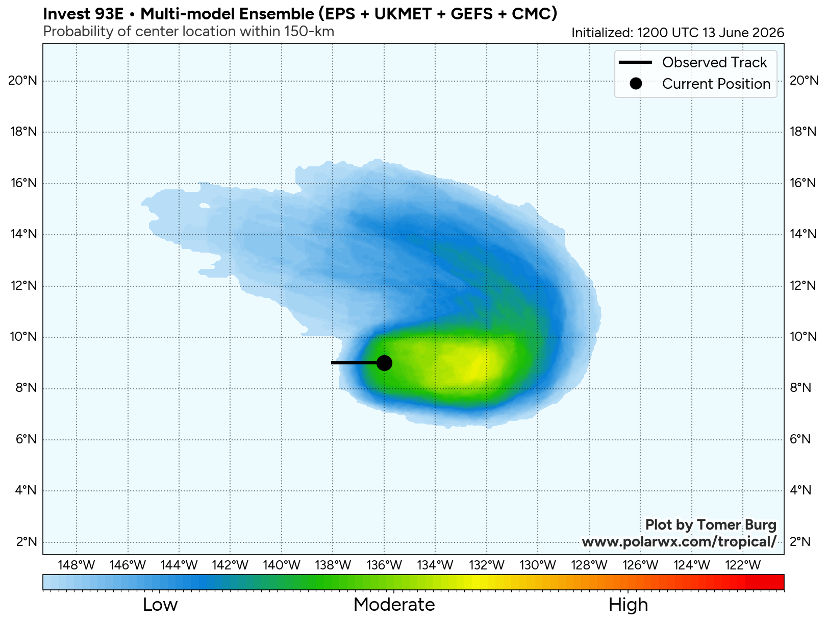
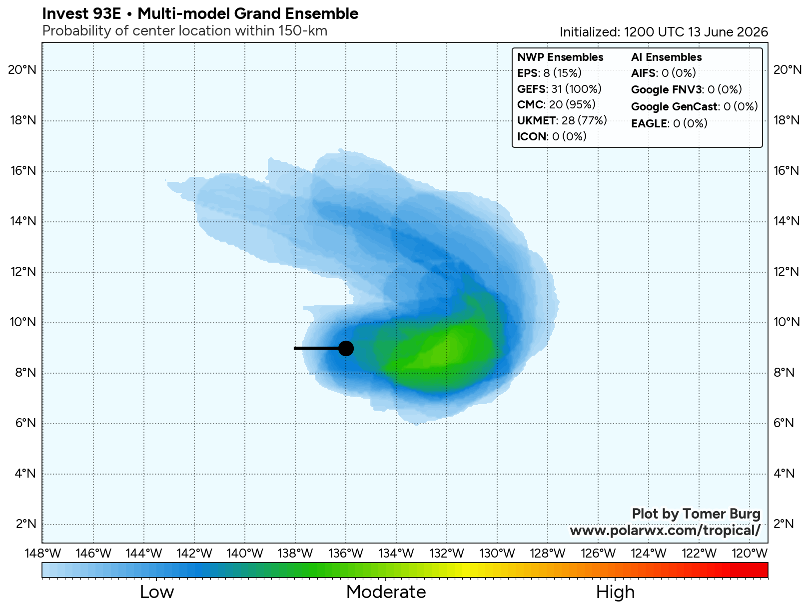
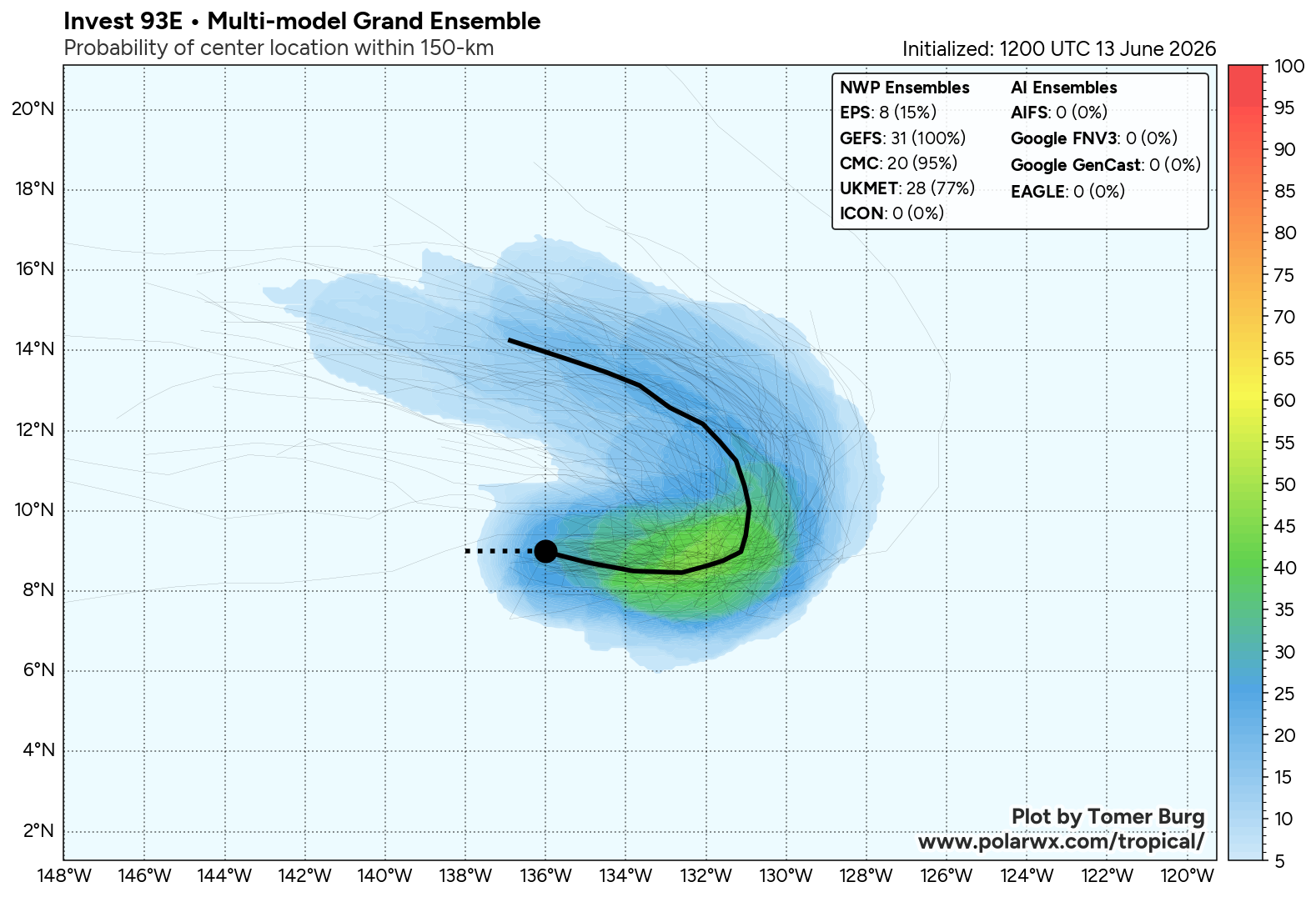
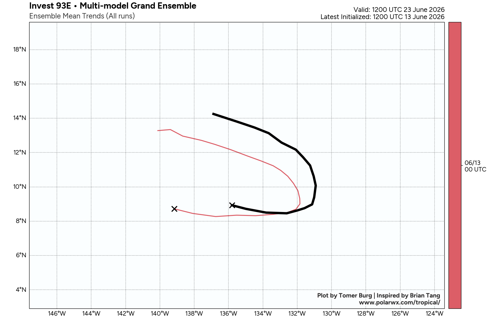
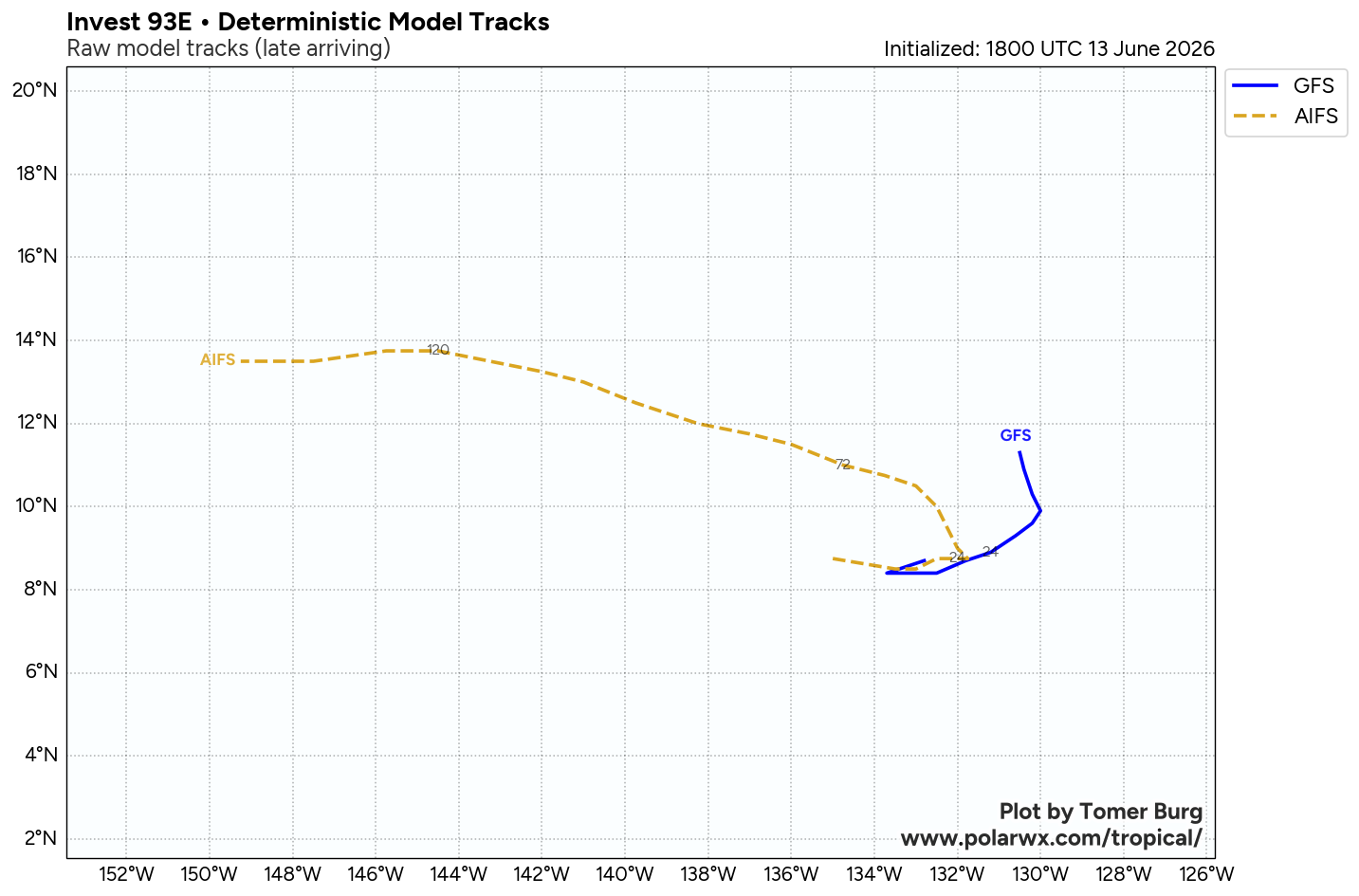
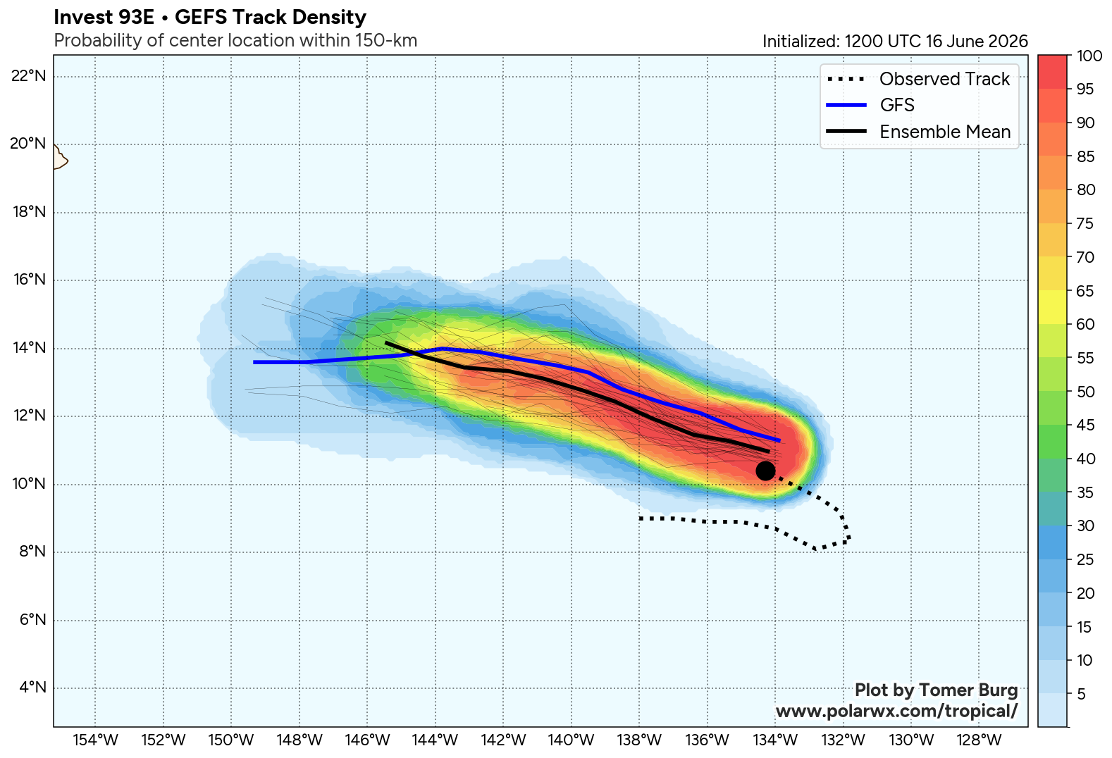
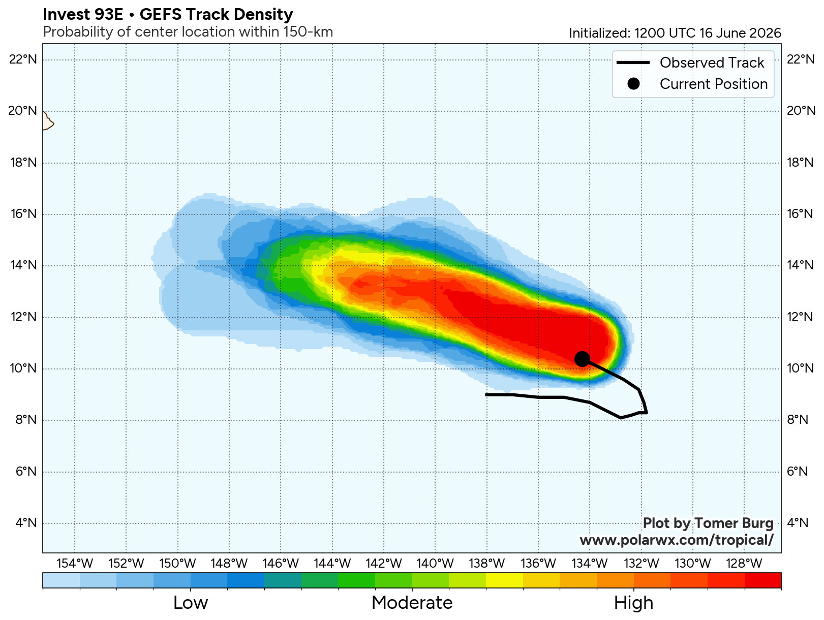
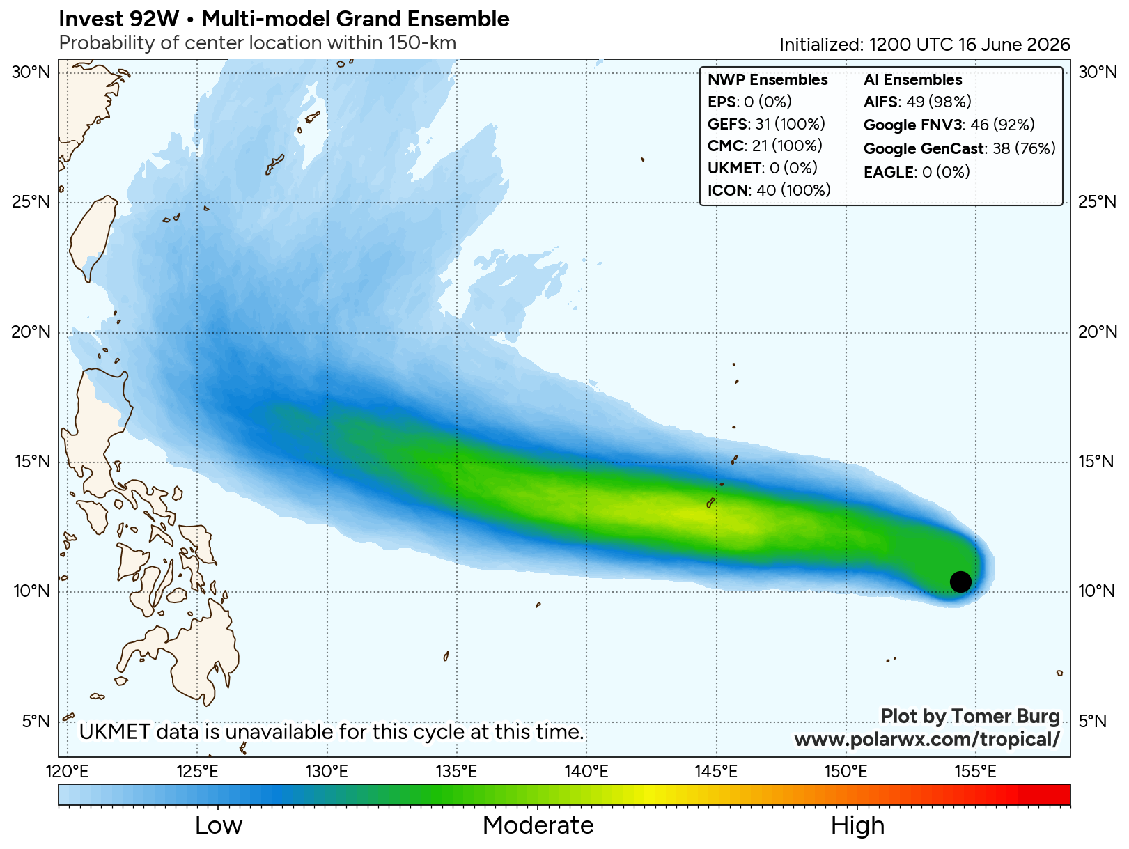
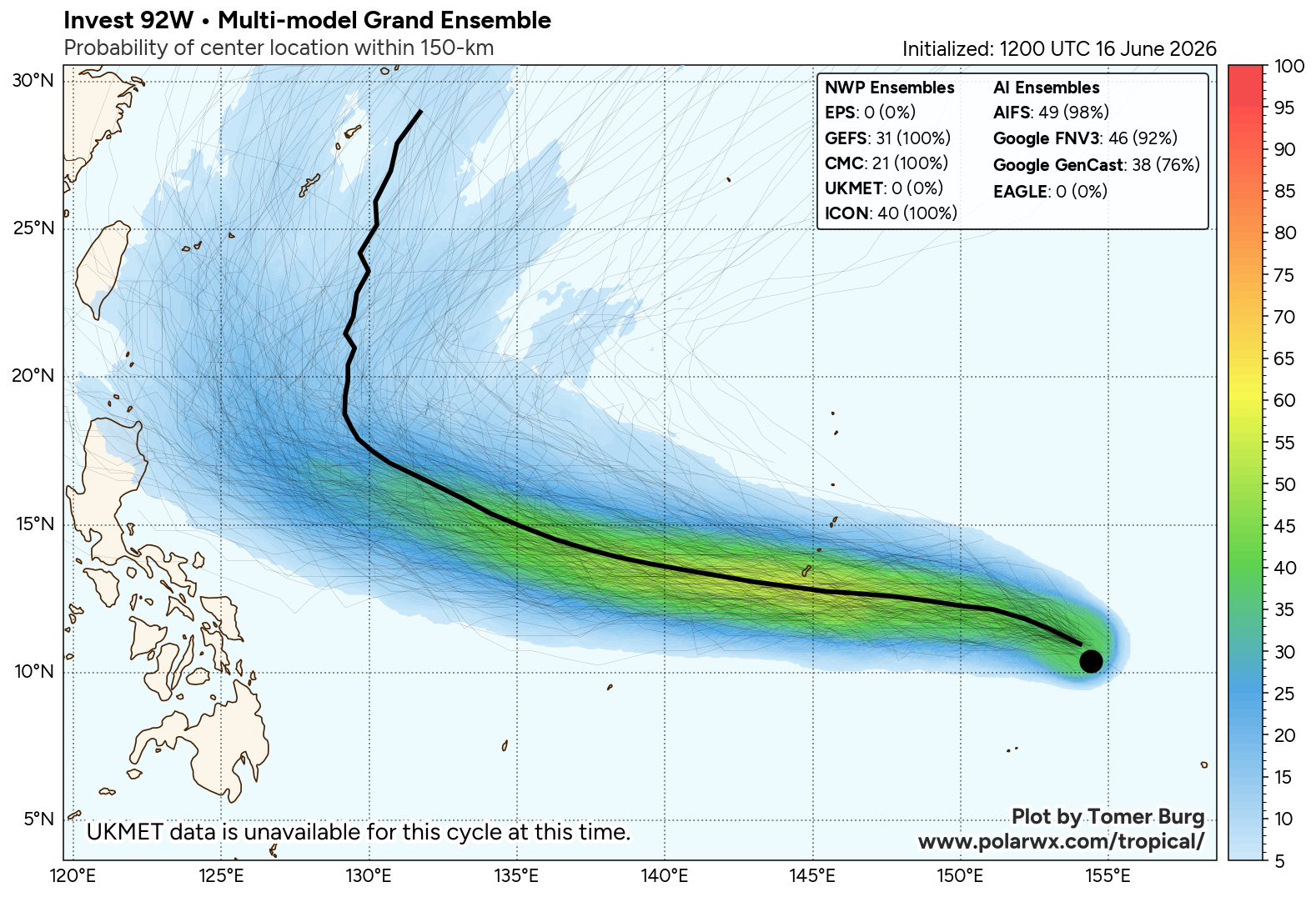
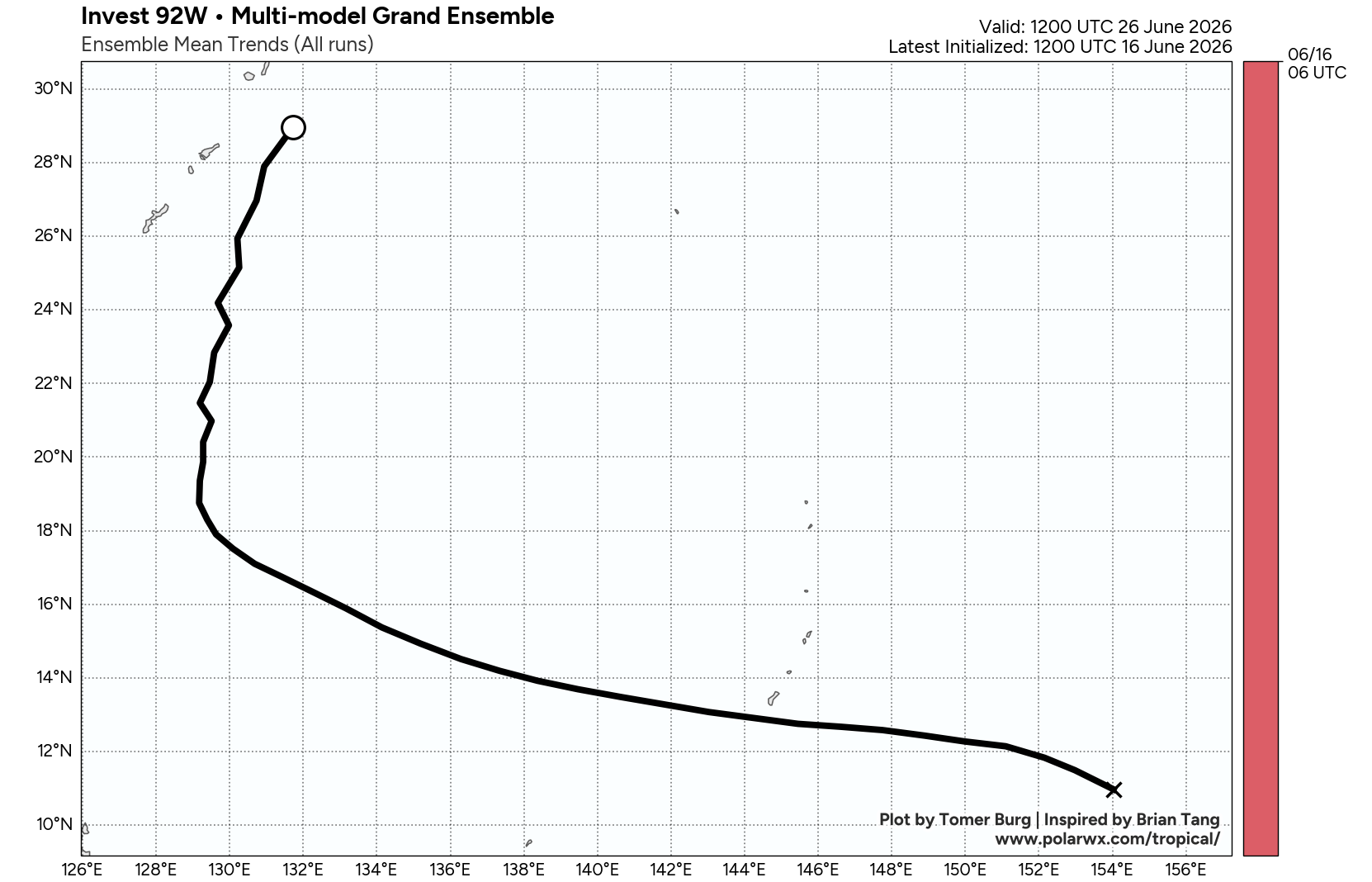
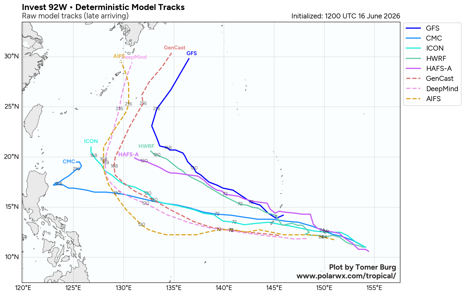
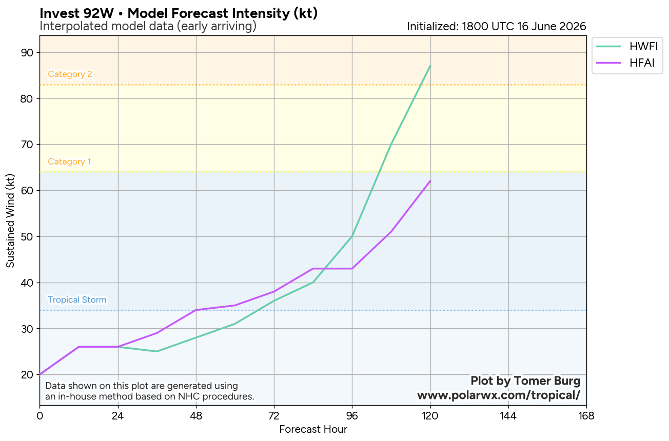
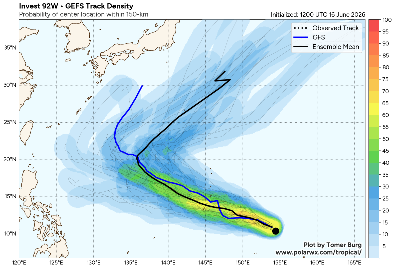
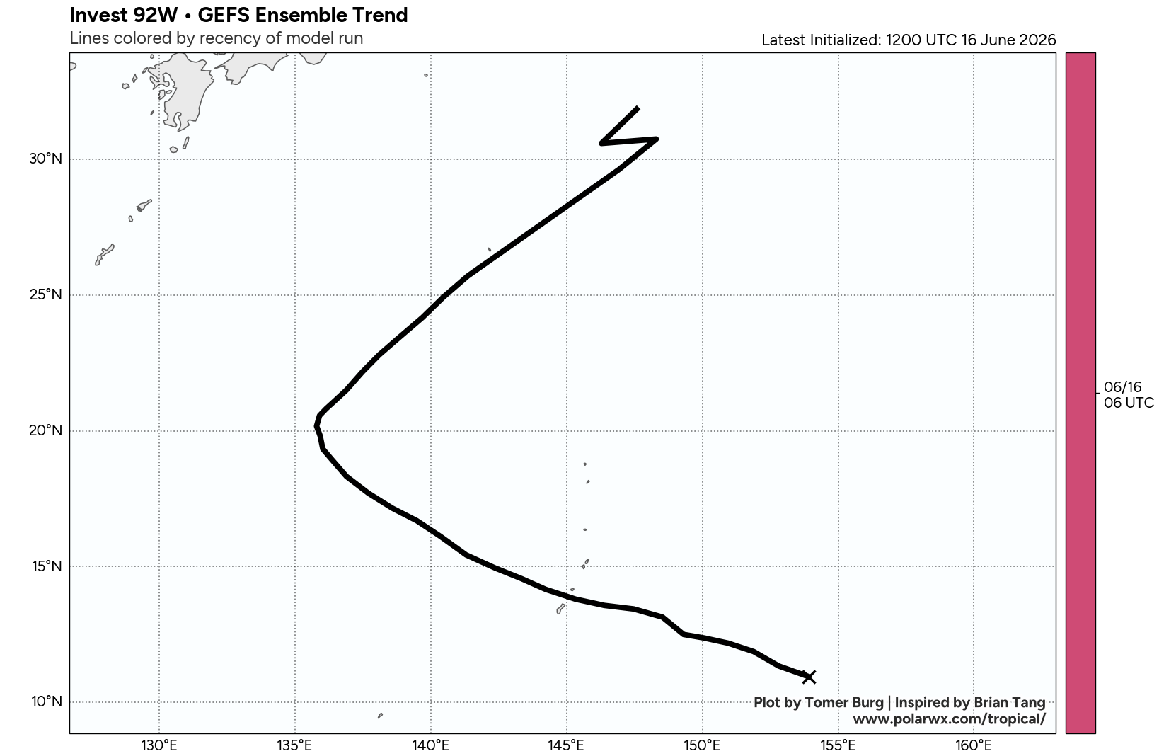
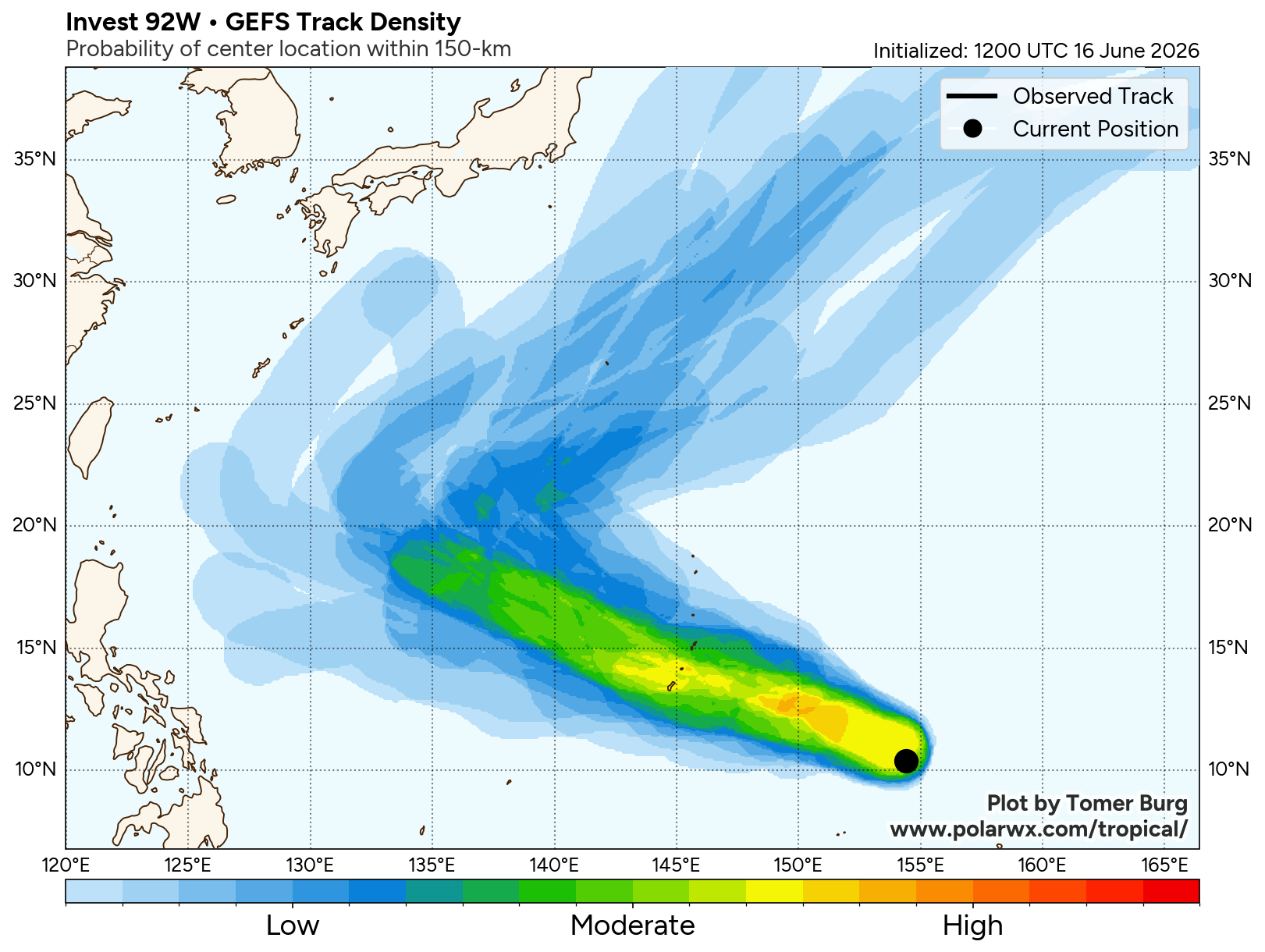
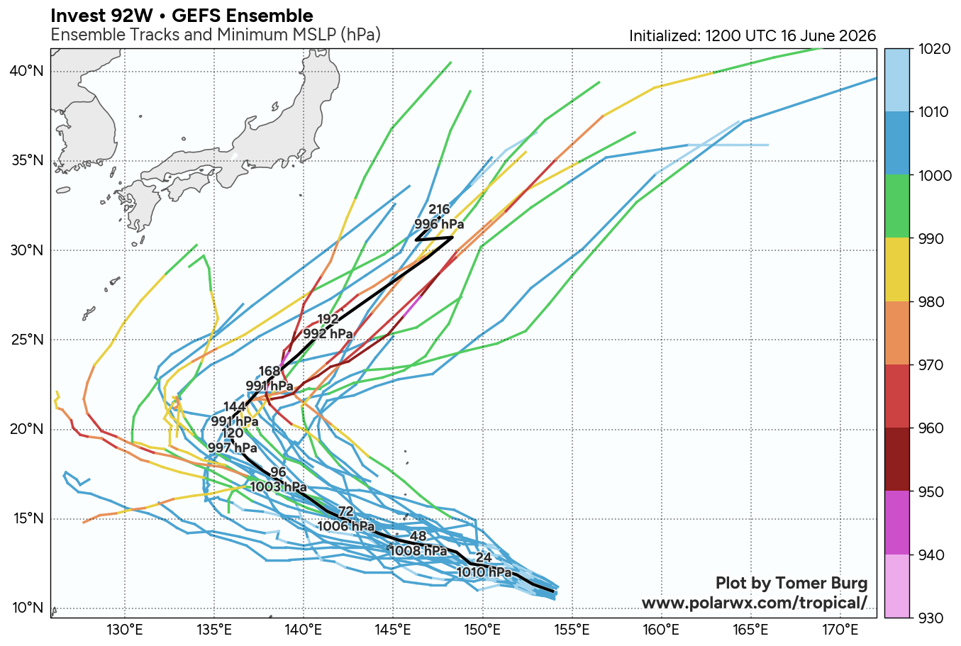
The area of convection (invest 92W) previously located near 10.4N 154.4E is now located near 11.1N 152.8E, approximately 494 nm east-southeast of Guam. Animated enhanced infrared satellite imagery (EIR) depicts 92W with patchy deep convective bursts obscuring an ill-defined low-level circulation center (LLCC) or wave cusp. A 161521z amsr2 microwave image shows disorganized convective features both north and south of the system center without much curved structure. Environmental analysis for the area is favorable for development with low vertical wind shear (10-15 knots), moderate radial outflow aloft, and warm sea surface temperatures (29-30 c). As the system is currently weak and disorganized, the pace of development will likely be slow in the near term. Deterministic models are consistent with this assessment, showing very gradual development over the next 48 hours, and are split on whether a tropical cyclone will form by that time. Global models agree on a generally west-northwestward track, taking the system into the vicinity of the southern mariana islands in about 48 hours. The exact track will depend on where a well-defined LLCC ultimately consolidates.
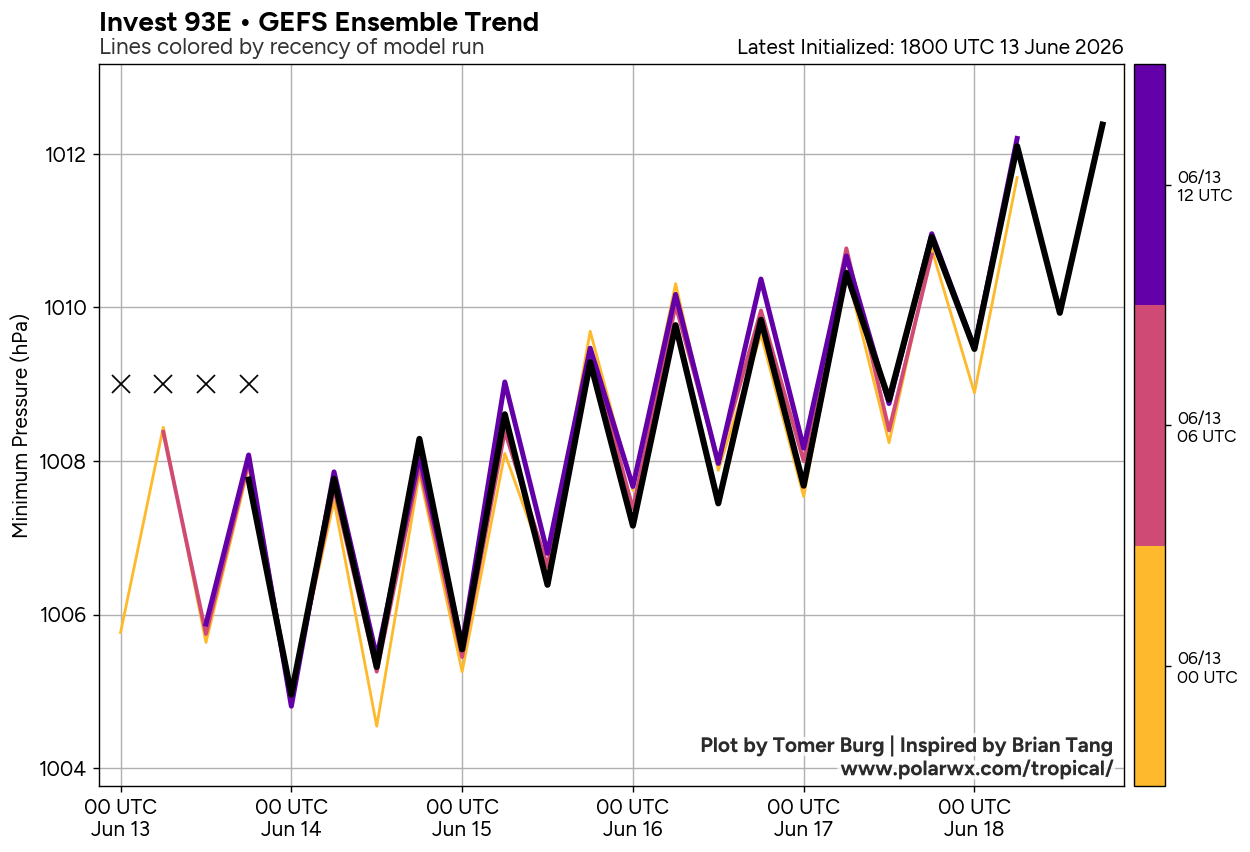
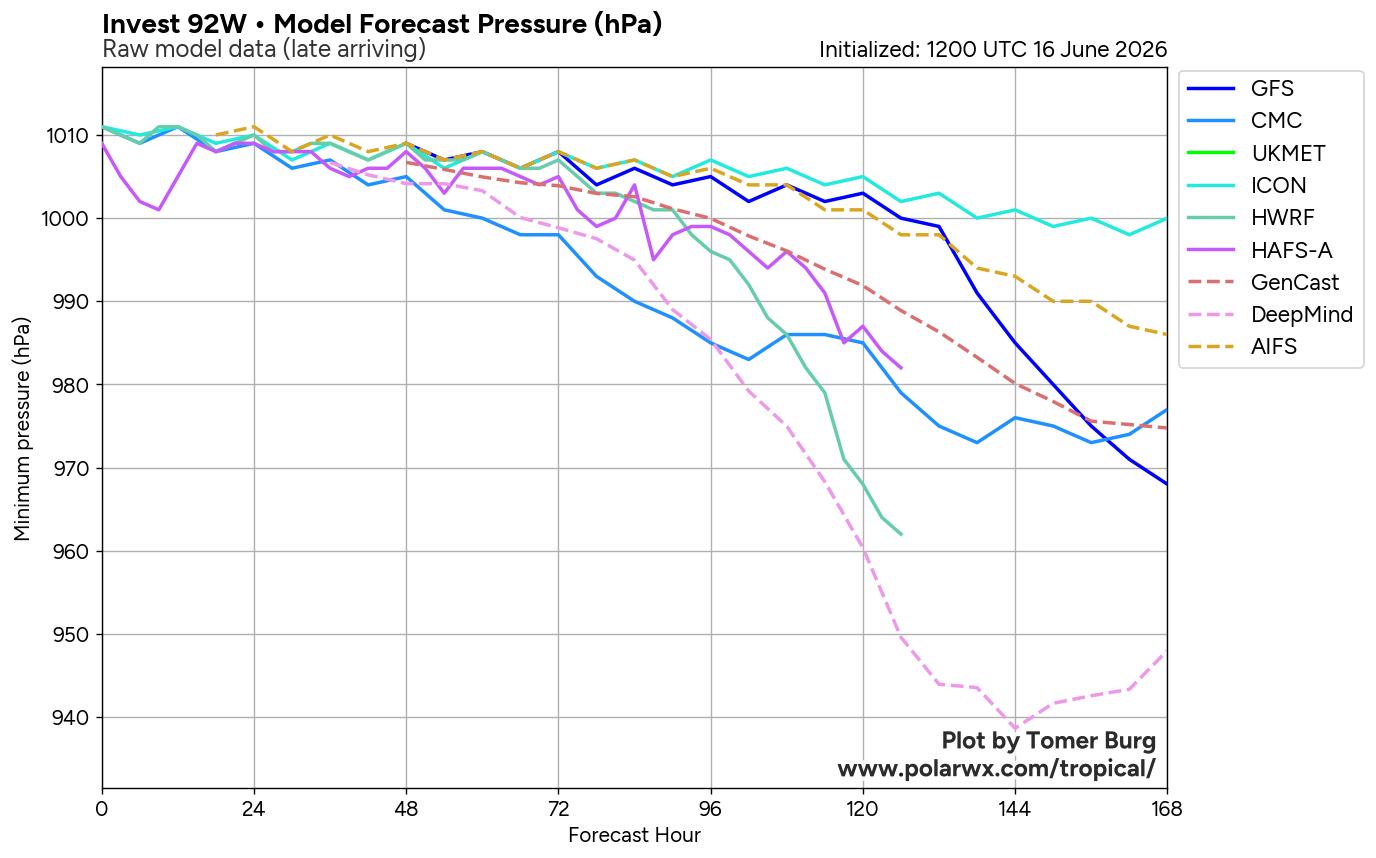
Maximum sustained surface winds are estimated at 18 to 23 knots. Minimum sea level pressure is estimated to be near 1008 mb. The potential for the development of a significant tropical cyclone within the next 24 hours remains medium.